
Key science findings:
- Identification of drought events across Great Britain using simulated river flow and soil moisture
- National analysis of future drought risk using MaRIUS baseline and future drought event-sets
- Enhanced modelling capability to include surface and groundwater abstractions and discharges in the Grid-to-Grid model
Introduction
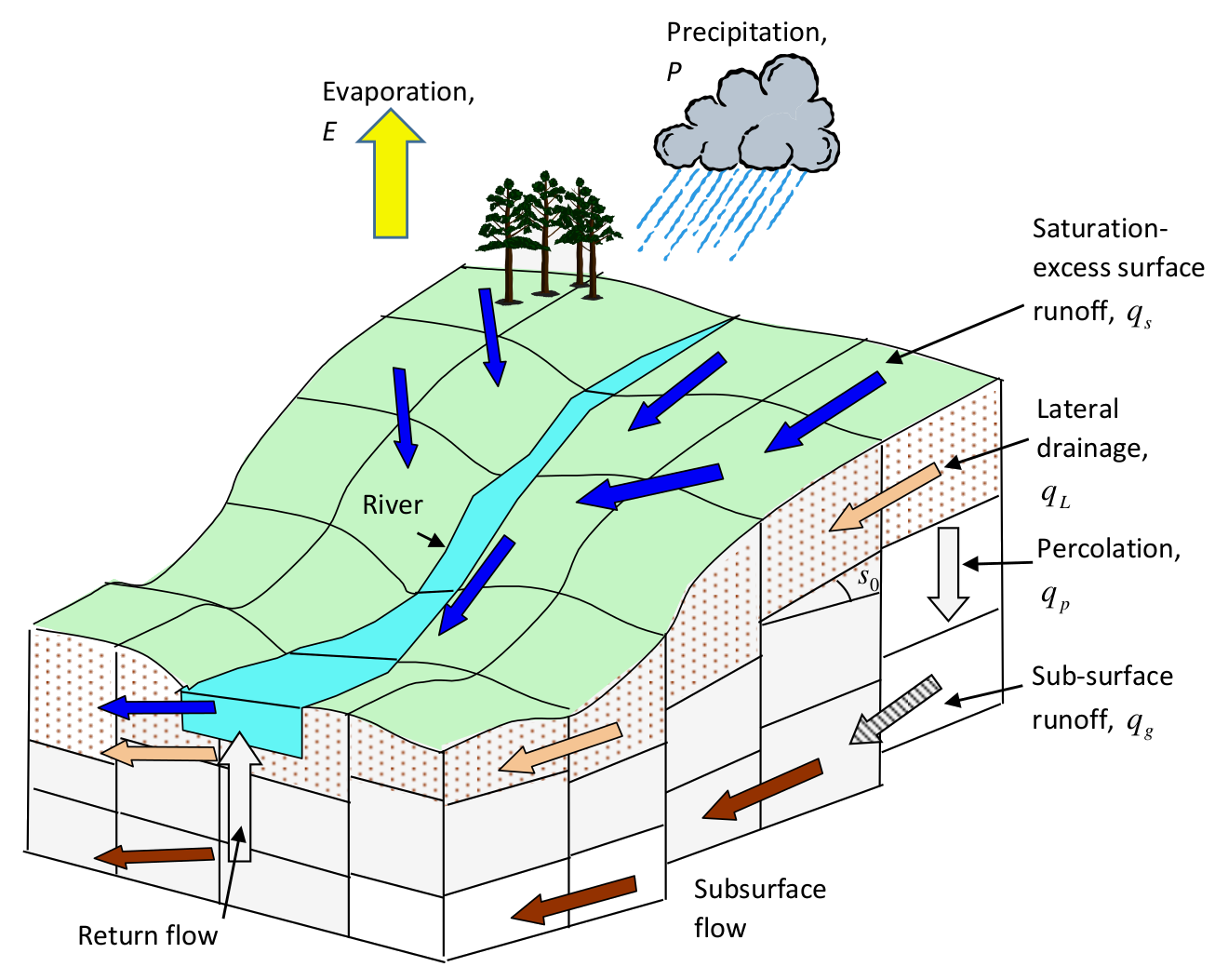
Work task B3 of the MaRIUS project delivers national scale hydrological modelling with the aim of providing enhanced scientific understanding and modelling capability for representing drought processes. To achieve this, research has focused upon the analysis of river flows and soil moisture for past and future droughts and the incorporation of abstraction and discharge data in a gridded national scale hydrological model.
Research methods
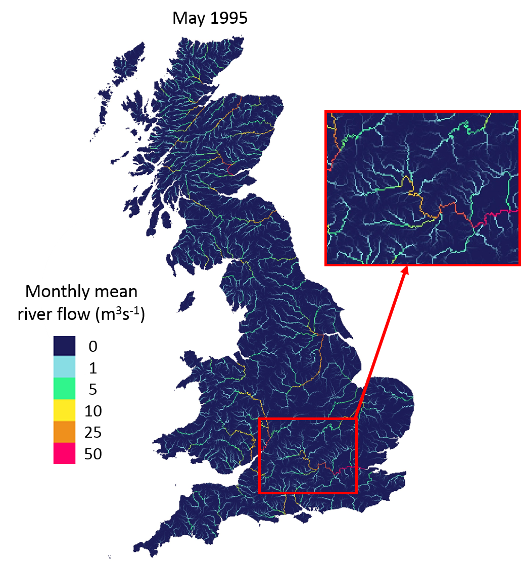
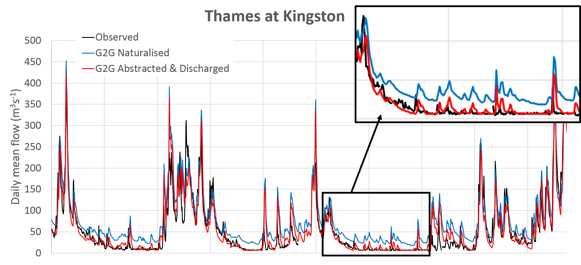
The Centre for Ecology and Hydrology’s (CEH) national gridded hydrological model Grid-to-Grid (G2G) provides 1km x 1km resolution estimates of naturalised river flows across the UK, and while originally developed to simulate and forecast high river flows, has now been assessed during low flow and drought conditions. A national scale model can maintain a national- or regional-scale water-balance, ensuring coherence between neighbouring catchments/regions and allowing assessment of the potential impact of water management scenarios on drought occurrence and severity at the national scale.
Ongoing work is using model estimates of river flows and soil moisture, driven by weather observations, to assess change in drought occurrence, duration and severity. An ensemble of near-and far- future weather outputs from multiple regional climate model simulations will provide the driving data needed to understand how drought occurrence and characteristics might change in the future.
Results
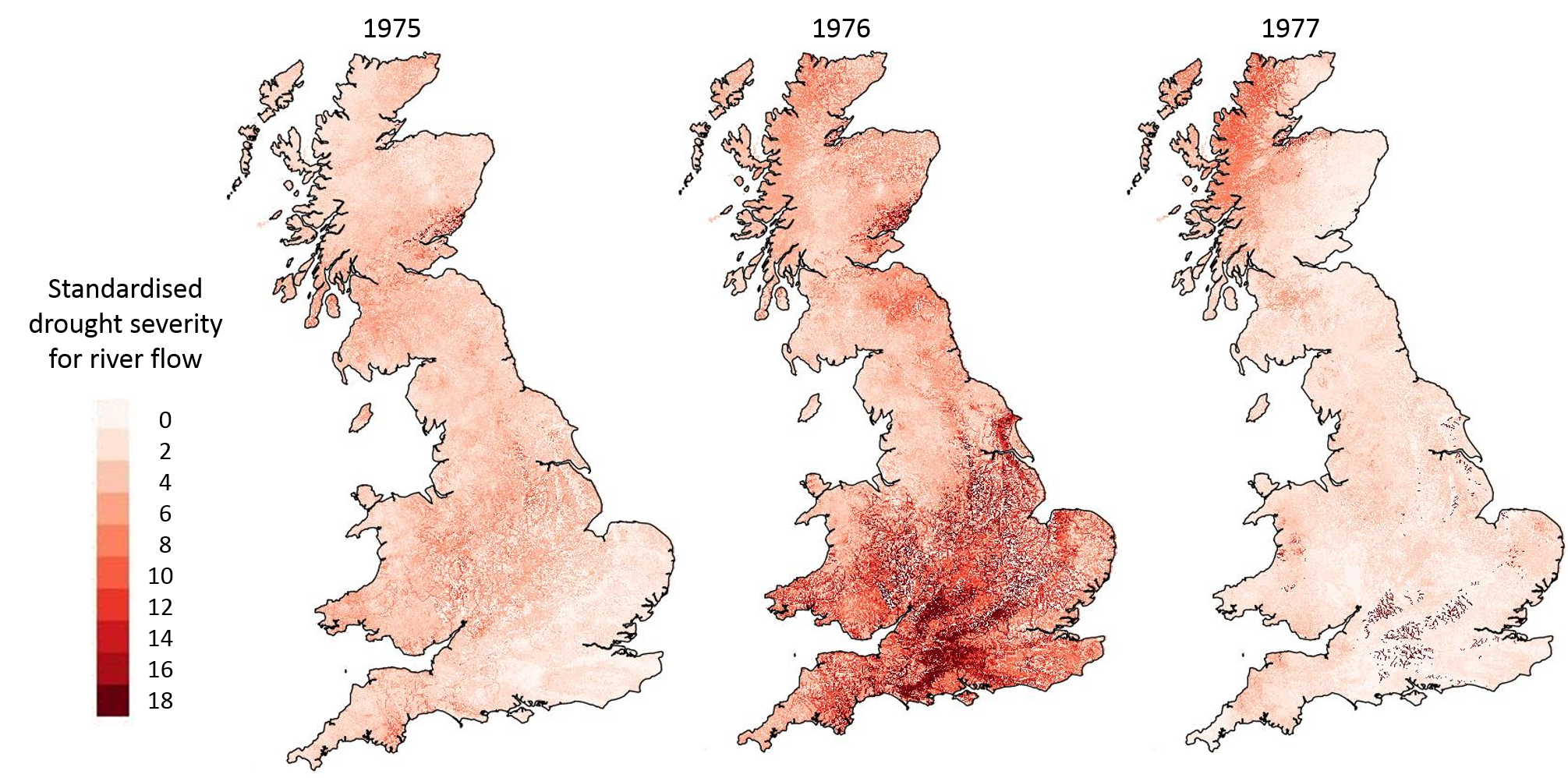
Identification of drought events across Great Britain using simulated river flow and soil moisture
Model estimates of river flows and soil moisture, driven by weather observations, have been used to assess change in drought occurrence, duration and severity throughout the 20th Century. This work will also include a low flow frequency analysis.
National analysis of future drought risk using MaRIUS baseline and future drought event-sets
An ensemble of near- and far-future weather outputs from multiple RCM simulations will provide the driving data needed to understand how drought occurrence and characteristics might change in the future.
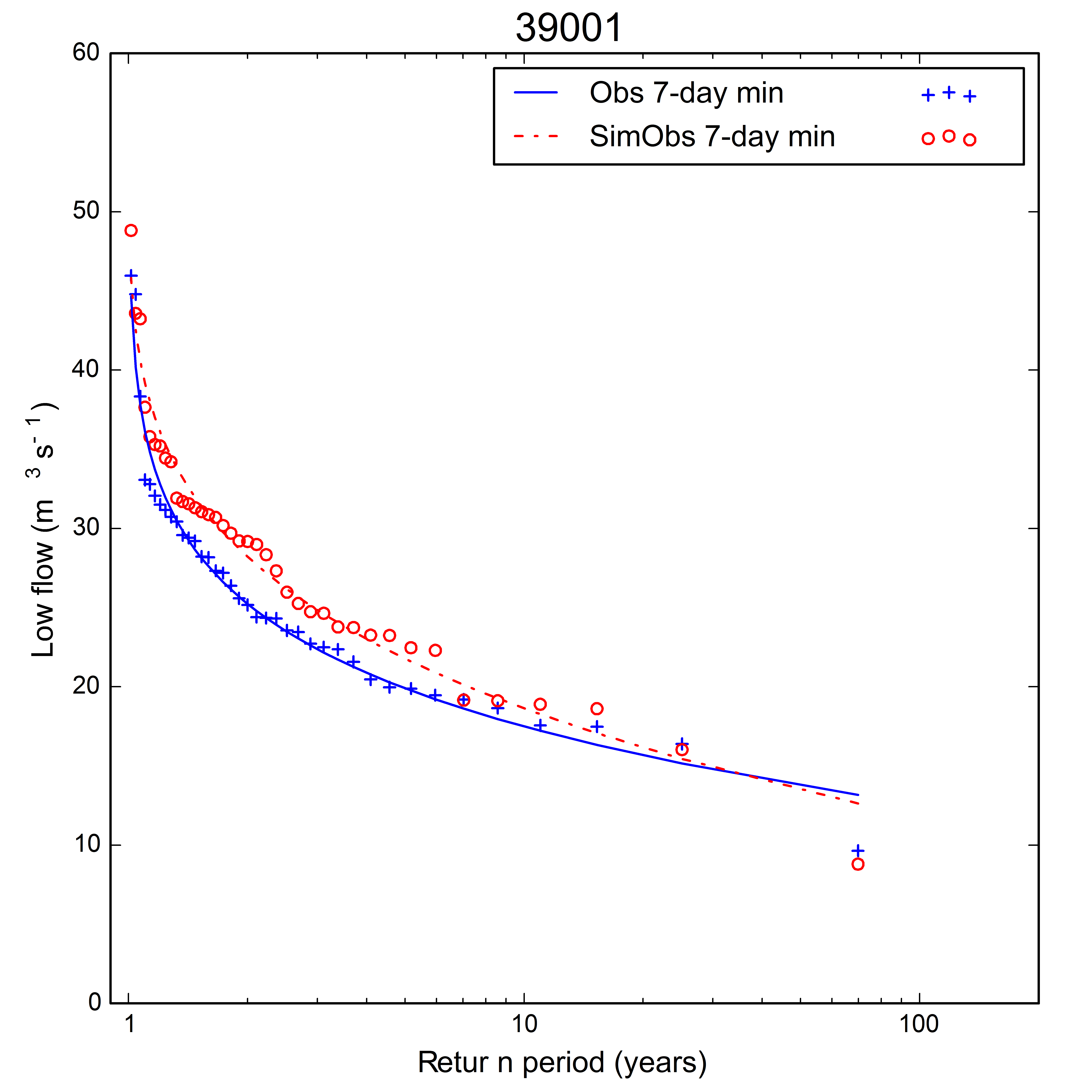
Enhanced modelling capability to include surface and groundwater abstractions and discharges in the Grid-to-Grid model
G2G has been enhanced to include the influence of abstractions and discharges on river flows
Further information
Visit the Management dashboard Management dashboard page
For more information visit the Droughts, people and management dashboard here
Poster presentations
- Rudd, A.C., Bell, V.A., Kay, A.L., and Davies, H.N. (2016) “Statistics in Weather and Climate”, Royal Statistical Society meeting, Reading, 21st March 2016.
- Rudd, A.C., Bell, V.A., Kay, A.L., and Davies, H.N. (2016) “National-scale hydrological modelling within MaRIUS: preliminary results on historic drought identification and trend analyses (1912-2011)”, The Historic Droughts Symposium, CEH, Wallingford, 22nd March 2016
- Rudd, A.C., Bell, V.A., Kay, A.L., and Davies, H.N. (2016) “A long-term national-scale hydrological simulation of river flows across Great Britain”, EGU 2016 (Vienna, 17-22nd April 2016).
Journal Papers
- Rudd, A., Bell, VA, Kay, AL, and Davies, HN. (2016) “National-scale modelling of hydrological droughts in Great Britain (1891-2015)” (in review).