The Environment Agency and water companies monitor droughts using various indicators or drought triggers. Triggers can be based on hydrological thresholds such as river levels and flows, reservoir storage and groundwater levels. Understanding the hydrological response to rainfall deficit is essential for drought risk assessment, management and water resource planning.
- See outputs from the different MaRIUS hydrological models for river flow, soil moisture, run-off, and ground water.
- How these outputs vary across spatial scales ranging from the Thames and Severn catchments to England and Great Britain.
- How these outputs vary for the baseline, near future and far future.
Hydrological models represent the land surface, rivers, vegetation and sub-surface water. In particular, they are used to estimate river flows and soil moisture for ecological and agricultural impacts assessment, as well as providing the basis for a water quality assessment.
Output from the hydrological models can be used within ecology, water resource management, farming, and economic modelling for further analysis of impacts of drought and water scarcity.
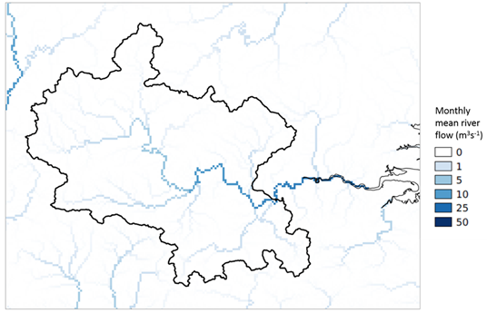
Thames basin: Monthly mean river flow for July 1976 (G2G output)